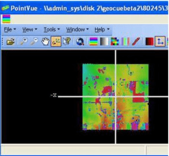
PointVue is a 3-D LIDAR visualization tool which can be used to visualize LIDAR data in ASPRS LAS Version 1.0 format. PointVue is included as part of GeoCue LIDAR 1
CuePac and is also available in a stand-alone version, PointVue LE.
The main PointVue window contains the following options:
- File: This menu category contains menu items that allow you to Open or Close a LIDAR file, Cleanup the list of most recently used LIDAR files, or Exit the program.
- View: This menu category contains menu items that provide various viewing options (Settings, Top, Bottom, Left, Right, Front, and Back) and display of the
elevation color map.
- Tools: This menu category contains menu items that allow you to view File Information and change PointVue settings.
- Window: This menu category contains menu items that support window options (tiling, creating new windows, etc.).
- Toolbar: The PointVue toolbar contains various tools to manipulate the viewing of the data.
The Access Point Scan Utility is a software program for the Sony Wireless LAN.


Comments